

Glasgow City Local Fire and Rescue Plan - Public Consultation
Glasgow City Local Fire and Rescue Plan – Public Consultation
The Scottish Fire and Rescue Service (SFRS) is seeking your views on the draft Local Fire and Rescue Plan for City of Glasgow 2026.
Glasgow is a vibrant and diverse city with communities that have different needs and challenges. We want to ensure our Local Fire and Rescue Plan reflects the issues that matter most to local people and helps us target our resources where they can make the greatest difference.
SFRS already work closely with our communities, local authority partners and third-sector organisations, but it is important that everyone has the opportunity to share their views and shape the services they provide. Whether you are a resident, business owner, community group or partner organisation, your feedback will help SFRS understand local priorities and continue improving outcomes for the people of Glasgow.
Your feedback will help ensure the final Plan:
- Reflects local priorities, risks and needs
- Supports effective partnership working
- Delivers the best outcomes for communities
- Informs local service delivery over the coming years
How to Take Part
You can view the draft Plan and complete a short consultation survey using the link below:
Consultations | Scottish Fire and Rescue Service
The consultation is open until midnight on Thursday 15 October 2026.
SFRS is committed to listening to the views of their communities and partners. Following the close of the consultation, feedback will be carefully analysed and a summary of the findings will be published, setting out how responses have informed the development of the final Plan.
Information provided by Scottish Fire and Rescue Service

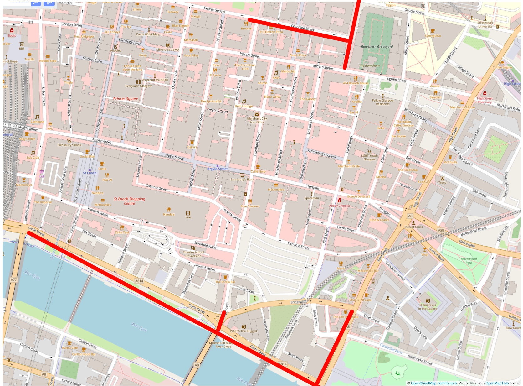
Great Scottish Run Road Closures, 2-4 October
Great Scottish Run Road Closures, 2 – 4 October
The Great Scottish Run takes place on 4th October. As a result, there will be road restrictions from 2nd – 4th October and road closures on Sunday 4th October. As George Square is still closed, the race starts further west on St Vincent St, finishing on Glasgow Greent
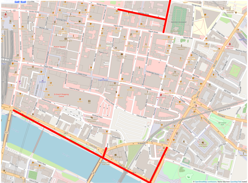
Roads in our area affected by closures are shown in red. Map data from OpenStreetMap
Prohibition of loading, unloading and waiting
15:00hrs on the 2 October 2026 until 16:30hrs on the 4 October 2026 and
Prohibition of vehicle movements
04:00hrs to 17:30hrs on the 4 October 2026
- A814 (eastbound), Finneston Street off Ramp
- A814 (eastbound), Finneston Street on Ramp
- A814 (westbound), Finnieston Street off Ramp
- Anchor Lane, for its whole length
- Anderston Quay, for its entire length
- Argyle Street, (Westbound), between Finnieston Street and St Vincent Street
- Argyle Street, from Berkeley Street to Finnieston Street
- Argyle Street, from Elliot Street to Finnieston Street
- Blythswood Street, between Blythswood Square and Bothwell Street
- Bothwell Street, between Wellington Street and Hope Street
- Broomielaw, for its entire length
- Broomloan Road, between Edminston Drive and Paisley Road West
- Carnoustie Street, between M74 off ramp and Scotland Street
- Clyde Arc Bridge, for its entire length
- Clyde Place, between George V Bridge and Glasgow Bridge
- Clyde Street, for its entire length
- Cochrane Street, for its whole length
- Commerce Street, between Kingston Street and Clyde Place
- Crown Street, from Saltmarket to Ballater Street
- Douglas Street, between Bothwell Street and St Vincent Street
- Dumbreck Road, between Paisley Road West and Titwood Road
- Dunlop Street, between Howard Street and Clyde Street
- Elderslie Street, between Dorset St and William Street
- Elmbank Street, between Elmbank Crescent and St Vincent Street
- Finnieston Quay, between Tunnel Street and Clyde Arc Bridge
- Finnieston Street, between Argyle Street and A814 Finnieston Street Off Ramp
- Finnieston Street, between Stobcross Road and Clyde Arc Bridge
- George Square, south side, for its entire length
- George Square, north side, for its entire length
- George Street between North Frederick Street and Albion Street
- George V Bridge, for its entire length
- Glasgow Bridge, for its entire length
- Gorbals Street, between Norfolk Street to Clyde Street
- Govan Road, between Clyde Arc Bridge and Pacific Drive
- Govan Road, between Lorne Street and Pacific Drive
- Greendyke Street, between Turnbull Street and Saltmarket.
- Haggs Road, between Titwood Road and Shawmoss Road
- Holland Street, between West George Lane and St Vincent Street
- Hope Street, between Waterloo Street and West George Street
- John Street, between Martha Street and George Street
- Lancefield Quay, for its entire length
- Lorne Street, between Paisley Road West and Govan Road
- M77 Northbound, off ramp to Dumbreck Road
- Mosspark Boulevard, between Dumbreck Road and Tanna Drive
- Montrose Street North Between George Street and Richmond Street
- Montrose Street South between Cochrane Street and George Street
- Newton Street, between Elmbank Crescent and St Vincent Street
- Nelson Mandela Place for its entire length
- North Hanover Street between George Square and Cathedral Street (access maintained to train station yard for authorised vehicles when safe to do so)
- Pacific Drive, between Govan Road and Finnieston Street
- Paisley Road West, between Helen Street to Paisley Road
- Paisley Road, between Paisley Road West and Seaward Street
- Pitt Street, between Bothwell Street and St Vincent Street
- Renfield Street, Between West George and St Vincent Street
- Saltmarket (Northbound), between Clyde Street and Bridgegate
- Saltmarket (Southbound), from St Andrews Street to Clyde Street
- Scotland Street, for its entire length
- Seaward Street, between Scotland Street and Paisley Road
- South Frederick Street, for its whole length
- St Vincent Place, for its entire length
- St Vincent Street, for its entire length
- Stockwell Street, between Bridgegate and Clyde Street
- Wellington Street, between West George Street and St Vincent Street
- West Campbell Street, between St Vincent Street and Bothwell Street
- West Nile Street, West George Street and Gordon Street
- West Street between Cook Street and Scotland Street
- West George Street between West Nile Street and George Square
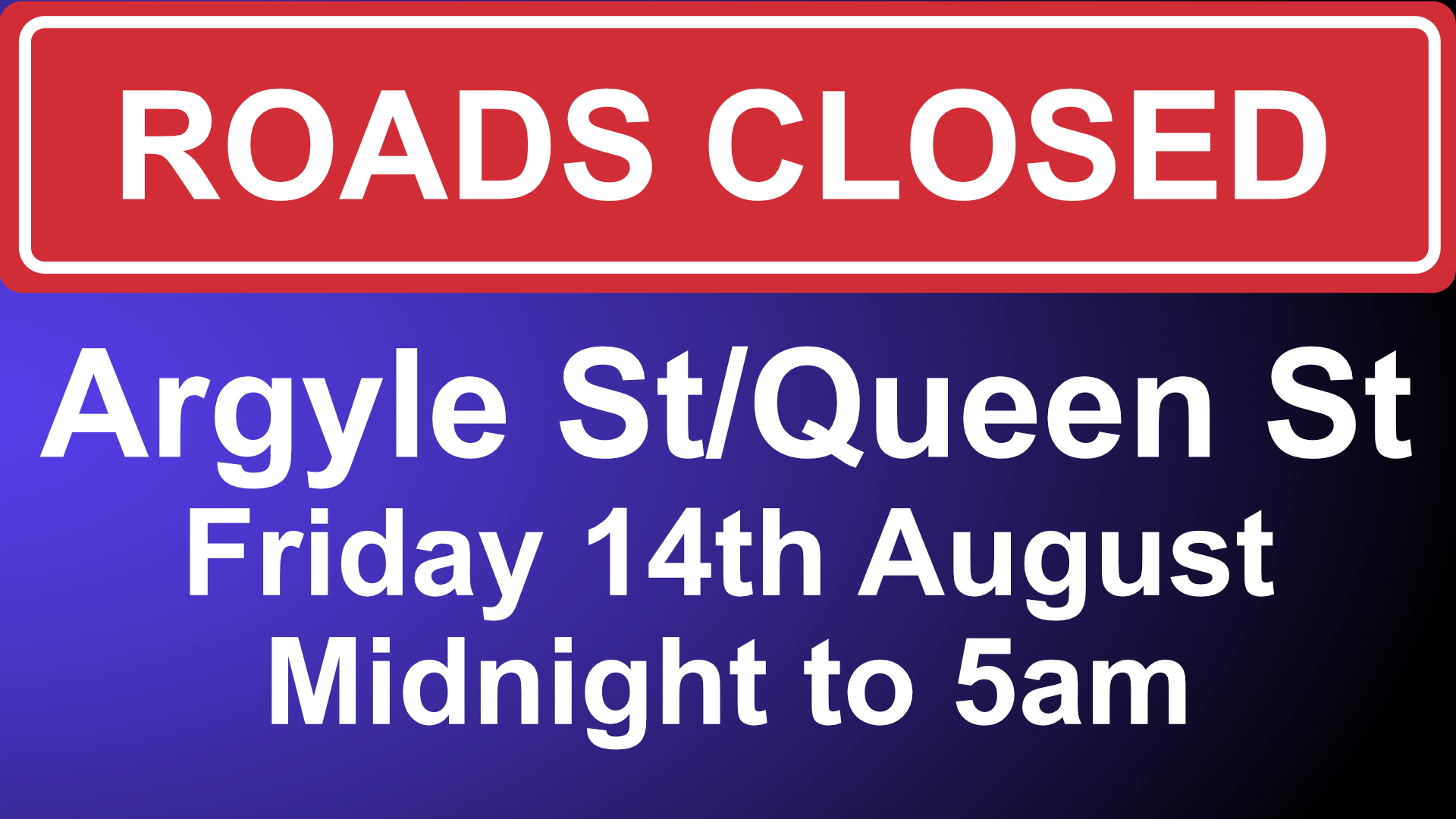
Argyle St and Queen St Overnight Road Closure Friday 14th August
Argyle St and Queen St Overnight Road Closure Friday 14th August
Works to install tree planters on Queen St, and Ingram St will take place on Friday 14th August, necessitating a full closure of Argyle Street/ Queen Street – from the junction of Jamaica Street, Union Street and Argyle Street. There will be local access only from the junction of Glassford/ Ingram St westbound. Diversions will be signposted.
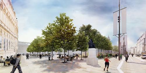
Queen St Junction with St Vincent St Closure from 4th August
Queen St Junction with St Vincent St Closure from 4th August
With construction of the new the southern carriageway of George square currently progressing, work on the Queen St-St Vincent Place junction will get underway on August 4. In keeping with the rest of the Square, granite stones will be laid across the new junction, pavements widened and new traffic lights installed. To ensure work is carried out safely and efficiently, the junction will be closed to all vehicles for the duration of the work, which is expected to last for ten weeks. Pedestrian access will be maintained across the junction for the duration of works while road traffic arrangements will be put in place to allow service vehicles to reach premises close to the junction.
Diversions and traffic changes…
During work on the Queen St junction, access to St Vincent place will be achieved from West George St via Anchor Lane. As this route cannot be used by vehicles over 10 metres long, service providers are advised to deploy suitably sized vehicles. The bus gate at Nelson Mandela Place will remain in operation, but an exemption for goods vehicles will be introduced while work is underway. A loading bay will also be created on St Vincent Place between Anchor Lane and George Square to help service vehicles reach business premises. To allow access to premises on Queen St to the south of the junction, the bus gates at the junction of Queen St and Ingram St will be suspended. Queen St will also become a temporary two-way street between the junction and Ingram St to allow vehicles to access. A diversion route for north and west bound traffic has been created along Ingram St, High St, George St, Montrose St, Cathedral St, North Hanover St, Killermont Street and West Nile Street. Road users are asked to plan their journey is advance to help minimise the impact of the closure on their travel. Bus passengers should check with their operator for any changes to their service.
Merchant City Festival Road Closures
Merchant City Festival – Road Closures
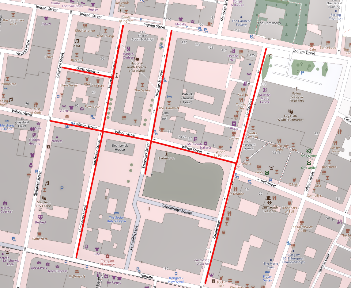
A reminder that Merchant City Festival is taking over this weekend and next, so there will be road closures on Garth, Hutcheson, Wilson, Brunswick Streets and Candleriggs:
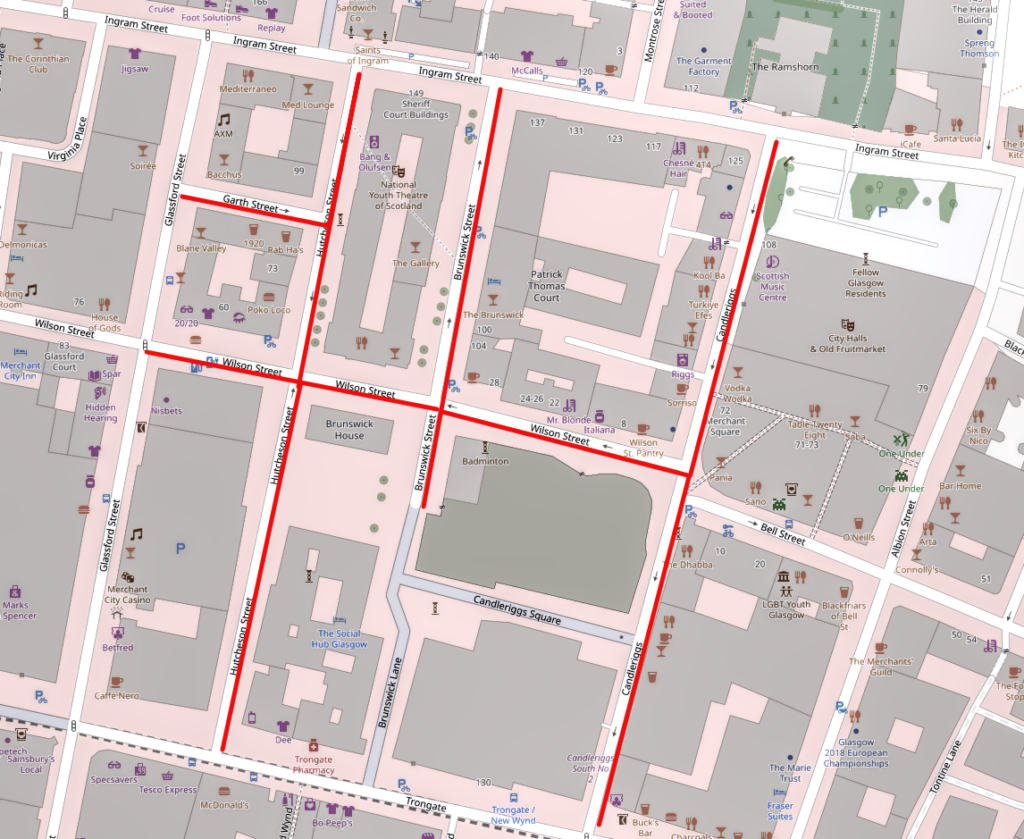
Roads affected by closures are shown in red. Map data from OpenStreetMap
Prohibition of waiting, loading and unloading from 3pm on the 22nd July until 11.59pm on the 26th July
- Brunswick Street between its termination point (dead end) and Wilson Street
Prohibition of waiting, loading and unloading from 3pm on the 23rd July until 11.59pm on the 26th July, and from 3pm on the 30th July until 11.59pm on the 2nd August
- Bell Street between Candleriggs and Walls Street
- Brunswick Street for its full length
- Candleriggs for its full length
- Garth Street for its full length
- Hutcheson Street for its full length
- Wilson Street between Glassford Street and Candleriggs
Prohibition of vehicle movements 6.00am on the 23rd July until 11.59pm on the 26th July 2026
- Brunswick Street between its termination point (dead end) and Wilson Street
Prohibition of vehicle movements 6.00am on the 24th July until 11.59pm on the 26th July 2026, and from 6.00am on the 31st July until 11.59pm on the 2nd August
- Bell Street between Candleriggs and Walls Street
- Brunswick Street for its full length
- Candleriggs for its full length
- Garth Street for its full length
- Hutcheson Street for its full length
- Wilson Street between Glassford Street and Candleriggs
Glasgow's Pride 18th July - Road Closures
Glasgow’s Pride 18th July – Road Closures
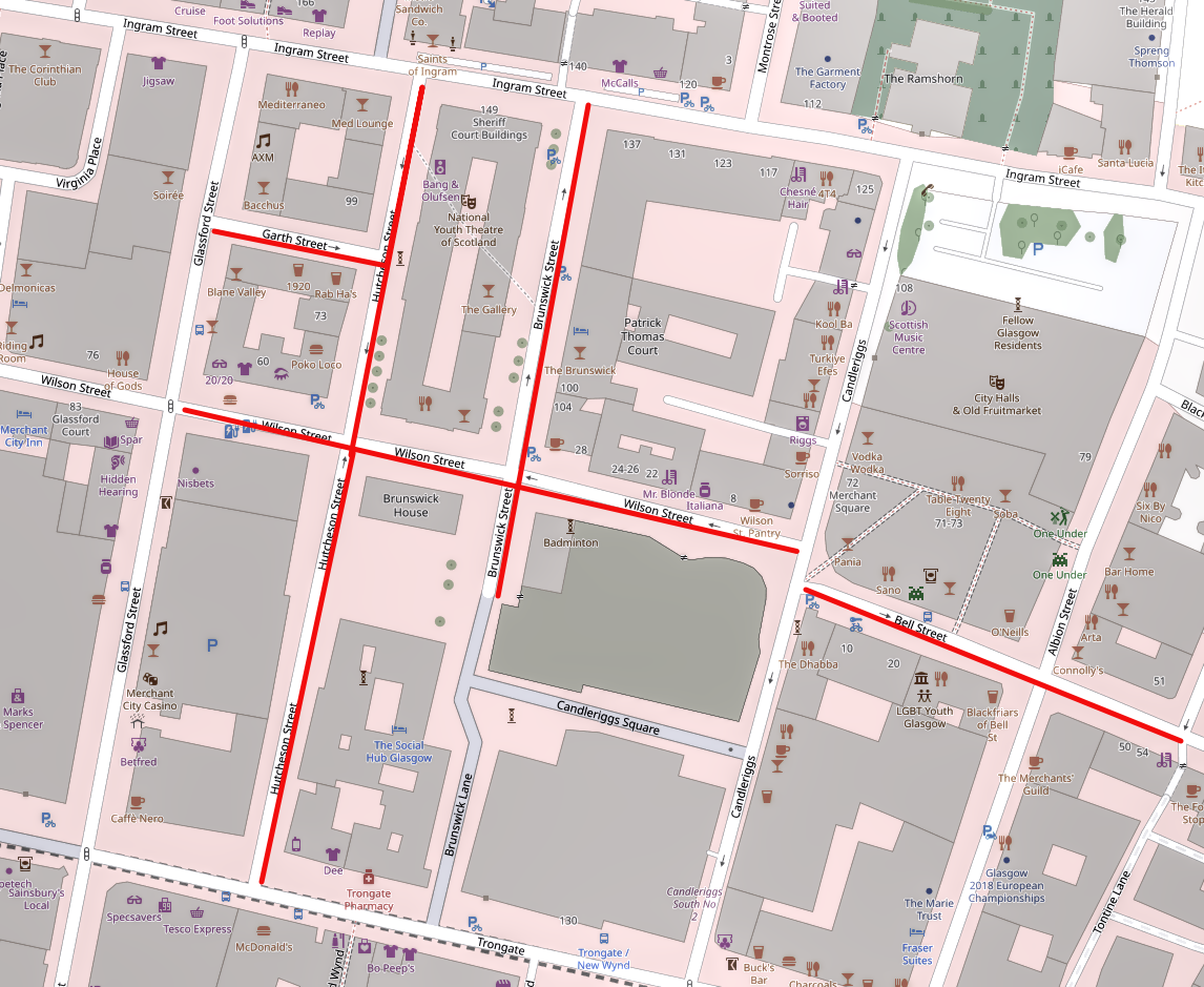
Glasgow’s Pride takes place on Saturday 18th July, with a stage in the Merchant City. As a result, there will be road closures in effect from 3pm on Friday 17th July, with no waiting restrictions from Thursday afternoon.
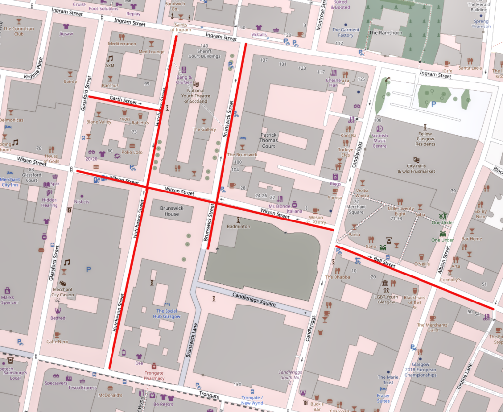
Roads affected by closures are shown in red. Map data from OpenStreetMap
| No Waiting, Loading, etc | No Vehicle Movements | |
| Hutcheson Street Brunswick Street Bell Street from Candleriggs to Walls Street Garth Street (access to residents parking will be maintained) Wilson Street from Glassford Street to Candleriggs |
From 3.00pm on Thursday 16th July To 11.59pm on Saturday 18th July |
From 3pm on Friday 17th July To 11.59pm on Saturday 18th July |
PROHIBITION OF VEHICLE MOVEMENTS
05:00hrs to 16:30hrs on the 1 October 2022
- Albion Street, for its entire length
- Bell Street, between Candleriggs and High Street
- Brunswick Street, for its entire length
- Candleriggs, for its entire length
- George Street, between Montrose Street and High Street
- Glassford Street, for its entire length
- Hutcheson Street, for its entire length
- Ingram Street, for its entire length
- Montrose Street,(Southbound) between George Street and Ingram Street
- Shuttle Street, for its entire length
- Trongate, for its entire length
- Wilson Street, between Glassford Street and Candleriggs
05:00hrs on the 1 October 2022 to 16:30hrs on the 2 October 2022
- Cochrane Street, for its whole length
- George Square, (east part), for its entire length
- George Square, (south part), for its entire length
- John Street, between Ingram Street and George Street
- Montrose Street (Northbound), between Ingram Street and Cochrane Street
- South Frederick Street, for its whole length
04:00hrs to 16:30 on the 2 October 2022
- A814 (eastbound), Finneston Street off Ramp
- A814 (eastbound), Finneston Street on Ramp
- A814 (westbound), Finnieston Street off Ramp
- Anchor Lane, for its whole length
- Anderston Quay, for its entire length
- Argyle Street, (Westbound), between Finnieston Street and St Vincent Street
- Argyle Street, from Berkeley Street to Finnieston Street
- Argyle Street, from Elliot Street to Finnieston Street
- Blythswood Street, between Blythswood Square and St Vincent Street
- Bothwell Street, between Wellington Street and Hope Street
- Broomielaw, for its entire length
- Broomloan Road, between Edminston Drive and Paisley Road West
- Brunswick Street, between Ingram Street and Wilson Street
- Carnoustie Street, between M74 off ramp and Scotland Street
- Clyde Arc Bridge, for its entire length
- Clyde Place, between George V Bridge and Glasgow Bridge
- Clyde Street, for its entire length
- Commerce Street, between Kingston Street and Clyde Place
- Crown Street, from Saltmarket to Ballater Street
- Douglas Street, between Bothwell Street and St Vincent Street
- Dumbreck Road, between St Andrews Drive and Mosspark Boulevard
- Dunlop Street, between Howard Street and Clyde Street
- Elderslie Street, between Dorset St and St Vincent Street
- Elderslie Street, between Houldsworth Street and St Vincent Street
- Elmbank Street, between Elmbank Crescent and St Vincent Street
- Finnieston Quay, between Tunnel Street and Clyde Arc Bridge
- Finnieston Street, between Argyle Street and A814 Finnieston Street Off Ramp
- Finnieston Street, between Stobcross Road and Clyde Arc Bridge
- George Square, all sides for its entire length
- George V Bridge, for its entire length
- Glasgow Bridge, for its entire length
- Gorbals Street, between Norfolk Street to Clyde Street
- Govan Road, between Clyde Arc Bridge and Pacific Drive
- Govan Road, between Lorne Street and Pacific Drive
- Govan Road, between Lorne Street and Pacific Quay
- Greendyke Street (Westbound), between Gallowgate and Saltmarket.
- Haggs Road, between Titwood Road and Shawmoss Road
- Harvie Street, for its entire length
- Holland Street, between West George Lane and St Vincent Street
- Hope Street, between West George Street and Waterloo Street
- Hutcheson Street, between Ingram Street and Wilson Street
- Ingram Street, (Westbound), between Hannover Street and Queen Street
- John Street, between George Street and Martha Street
- Lancefield Quay, for its entire length
- Lorne Street, between Paisley Road West and Govan Road
- M77 Northbound, off ramp to Dumbreck Road
- Montrose Street,(Southbound) between George Street and Ingram Street
- Mosspark Boulevard, between Dumbreck Road and Bellahouston Drive
- Nelson Mandela Place for its entire length
- Newton Street, between Elmbank Crescent and St Vincent Street
- North Hanover Street between George Square and Cathedral Street
- Pacific Drive, between Govan Road and Finnieston Street
- Paisley Road West, between Helen Street to Paisley Road
- Paisley Road, between Paisley Road West and Seaward St
- Pitt Street, between Bothwell Street and St Vincent Street
- Queen Street, between Ingram and George Square
- Renfield Street, Between West George and St Vincent Street
- Saltmarket (Southbound), from St Andrews Street to Clyde Street
- Saltmarket (Northbound), between Clyde Street and Trongate.
- Scotland Street, from West Street to Seaward Street
- Seaward Street, between Scotland Street and Paisley Road
- Shields Road, between Scotland Street and St Andrews Drive
- St Andrews Drive, between St Andrews Close and Dumbreck Road
- St Vincent Place, for its entire length
- St Vincent Street, for its entire length
- Stockwell Street, between Bridgegate and Clyde Street
- Wellington Street, between West George Street and St Vincent Street
- West Campbell Street, between St Vincent Street and Bothwell Street
- West George Street between West Nile Street and George Square
- West Nile Street, (Southbound) between Bath Street and Gordon Street
- West Street between Cook Street and Scotland Street
Mens 10K 2022 - Road restrictions
The following roads will have a No waiting and no loading or unloading restrictions from 15:00hrs on 18 June 2022 to 16:00hrs on the 19 June 2022
The same roads will have a Prohibition of vehicle movements from 06:00hrs to 16:00hrs on 19 June 2022
Argyle Street, between Hope Street and Queen Street
Albion Street, between Trongate and Access to Multi-storey Car Park
Bridgegate,between Kings Street and Saltmarket
Broomielaw, (Westbound), between Glasgow Bridge and Brown Street
Buchanan Street, between Argyle Street and St Vincent Place
Candleriggs, for its entire length
Cochrane Street, for its entire length
Clyde Street, between Crown Street and Bridegate
George Square (South), for its entire length
Glassford Street, for its entire length
George Street, between North Frederick Street and John Street (restricted loading and waiting only)
Hanover Street, for its entire length
High Street, between Bell Street and Gallowgate
Ingram Street, between Queen Street and Albion Street
Miller Street, full length (restricted access only)
Montrose Street, between George Street and Ingram Street
North Hanover Street, between Cathedral Street and George Square
Oswald Street, for its entire length
Queen Street, for its entire length
Saltmarket, between Trongate and Crown Street
South Frederick Street, for its entire length
Stockwell Street, between Howard Street and Trongate
Trongate, for its entire length
Wilson Street, between Hutcheson Street and Virginia Street